The new ones are kinda short. This may explain some of that.

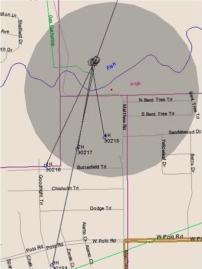
The longer one you see is API# 113-30193 (3H) ~
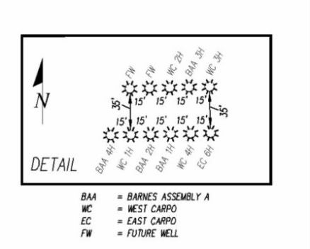
Those pentagon (5-sided) shapes you see are apparently two (maybe three) Pad Sites Leaseholds converging at 4351 Matthew Road with currently 5 different wells permitted and/or drilled from potentially 4 separate leaseholds (that we know of) including...Barnes Assembly A, West Carpo, East Carpo and 2 "Future Wells." There will be up to 11 wells drilled (at this time) from this location according to the Detail Map Below.
Notice the Gas Gathering Pipeline (in green) that will get the gas out of there. What was once a beautiful and tranquil cow pasture is clearly now an industrial zone.
Notice the Gas Gathering Pipeline (in green) that will get the gas out of there. What was once a beautiful and tranquil cow pasture is clearly now an industrial zone.
Oh, and there's Fish Creek, too ~ see it in bright BLUE on the Map. A well-known old creek in southern Grand Prairie that runs right above all the drilling and horizontal, hydraulic fracturing that will be going on in that area in the immediate future.
And the latest "Detail" of this area as currently shown on Railroad Commission Maps for these permits. (This seems to have changed over a short time. Not sure what happened to Barnes Assembly B that used to show up. Maybe it sounded too much like Barnes Assembly A or maybe it's been put on the Chesapeake shelf for now.)

No comments:
Post a Comment